


A beach destination looks, on a live map, like the easiest geography in the world: a strip of sand, a coast road, a line of hotel pins. Travellers book on that view and then discover the coast’s fine print the hard way — the resort an hour’s walk from any restaurant, the beautiful cove with no road to it, the ferry that left ten minutes before their bus arrived, the famous beach that faces the weather wrong for the month they chose. Coasts are routes, not backdrops, and they reward being read in advance. This article sets out what the TTweakMaps map guide — the map-guide layer of TravelTweaks — covers for beach and resort destinations: the coastline as a journey, the clusters where the resorts gather, the piers the boats leave from, and the seasons that quietly decide everything.
Why a coastline needs its own kind of guide
The standard definition of a resort is a self-contained place — everything inside the fence. That is precisely the planning problem: a resort is designed so that you never need to know what is outside it, which means the map app shows you a pin in a void. What a traveller actually needs to know about a coastal strip is relational: how far the resort is from the town, the marina, the reef, the airport road; which beaches lie along the coast in which order; where the coast road is a fast dual carriageway and where it narrows to a cliff lane behind a donkey cart. None of that is navigation. All of it is a guide’s natural material, and it is gathered here the same way as in our general walkthrough of map guides TTweakMaps, from first search to final destination — the coast simply becomes the route.
Resort clusters: reading a strip before you book
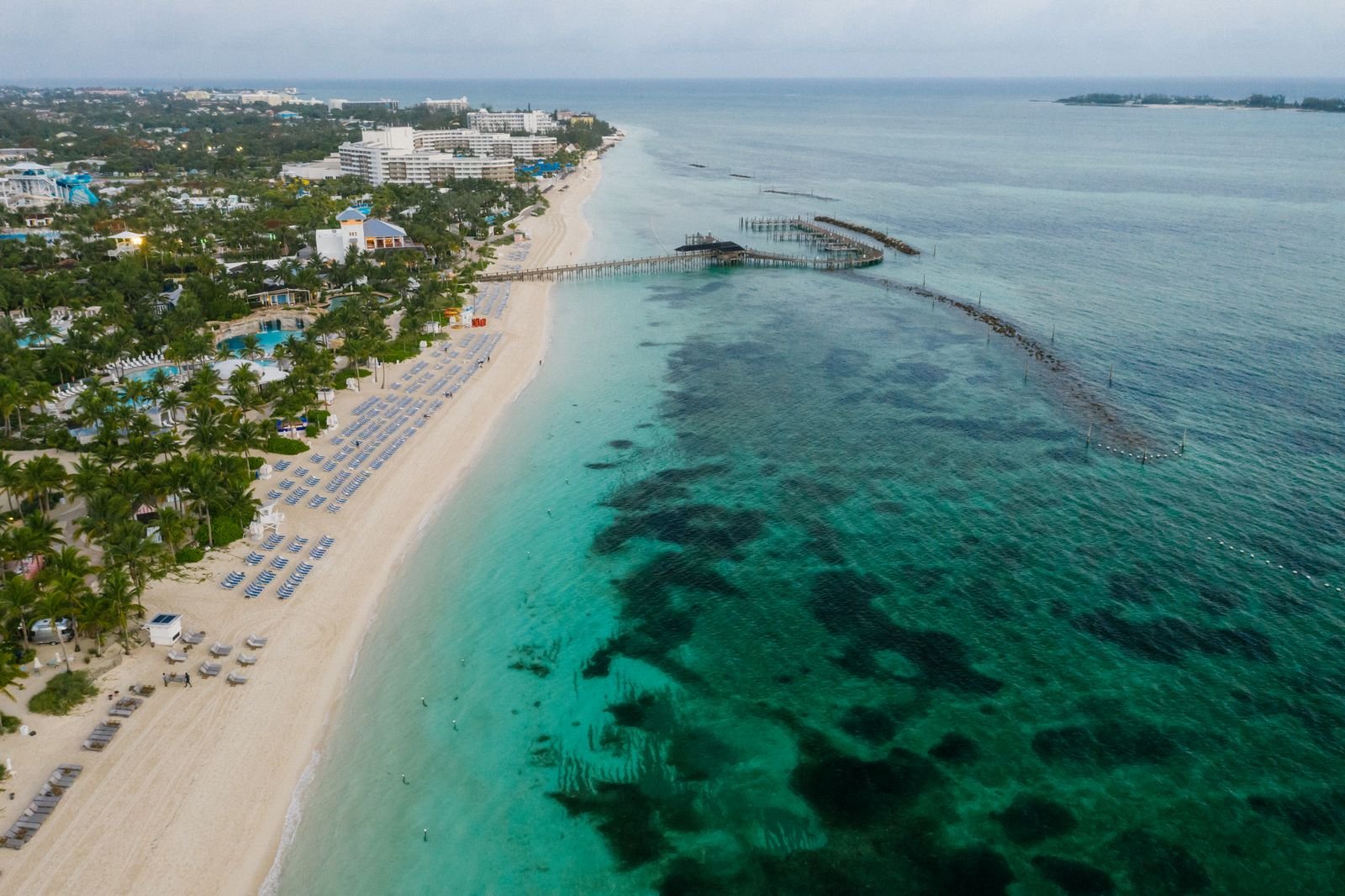
Resorts are rarely evenly spread along a coast; they gather in clusters, and each cluster has a character the booking photos never mention. The guide grades every cluster on the things that decide a stay:
- What the cluster actually is — a purpose-built strip of large hotels, a fishing village that grew rooms, a marina development, a scatter of small guesthouses along a bay.
- The walk-out test — what you reach on foot in fifteen minutes: restaurants not owned by your hotel, a shop, a bus stop, the neighbouring beach. A cluster that fails this test means every evening is a taxi negotiation.
- Noise and quiet — which end of the strip the beach clubs and bars occupy, and which end the families and the early swimmers choose.
- The sea itself — sheltered bay or open coast, reef or sand entry, the side the afternoon wind hits. Two resorts five hundred metres apart can have different oceans.
Read this way, the cluster notes turn the room decision into a place decision — which is where it pairs with the money end of the trip: our numbers-first breakdown of TTweakHotel discount codes helps with what you pay for the room, and the cluster grading helps you make sure it is the right room, in the right cluster, before the code ever gets typed in.
Beach-hopping: the coast as a route
The best day on most coasts is not spent on one beach; it is a small journey between several — the busy bay in the morning, the cove with the one taverna for lunch, the west-facing beach for the last swim and the sunset. The guide treats that day as a stage, with the same honesty as a mountain route: the order the beaches fall along the coast and the direction that avoids backtracking, real times between them at the pace the coast road imposes, where parking actually exists, and which coves are reached by boat, by path or not at all by car. It also marks the decision points — the junction where you commit to the far beach or turn back for the cluster — because a coast road at dusk, with the last bus gone, is no place to improvise. In regions like the Caribbean, where a single island can hold a sheltered leeward coast and a wild Atlantic side within an hour’s drive, this sequencing is the difference between a route and a random shuffle of beaches.

Ferry piers and the last boat home
Where a coast involves islands, the pier becomes the most important pin on the map — and the one live navigation treats most casually, as if a ferry terminal were a bus stop. The guide documents piers the way the multi-country range documents border crossings: which pier the boat for your island actually leaves from (ports grow; the fast catamaran and the car ferry rarely share a quay), check-in reality and how early to be there, and the timing that rules the day — the last boat back, printed in the stage notes where the day’s plan is made. It flags the classic trap by name: an itinerary that works perfectly until you lay the ferry timetable over it and watch the final connection fail by ten minutes. Travellers working through when and how to use map guides TTweakMaps will recognise the principle — decisions chained together have to be planned together — and nowhere chains tighter than a coast with boats in it.
Seasons on the coast: the notes that decide the trip
A beach is a promise the calendar makes, and the guide prints the terms. Each coastal route carries seasonal notes in outline: the rainy and hurricane months for that coast and what they do to the sea, not just the sky; the season when the famous beach is weed-covered or the swell makes it a surf beach rather than a swimming one; the weeks the resort strip is half-closed and the weeks it is full and priced like it. None of this replaces a forecast or an official source close to departure — it exists so the trip is planned in the right month to begin with, and so the stage notes can suggest the sheltered alternative the guide already knows when the weather turns. A coastal stage also ends, like any stage, in a town with beds in it; where the cluster is a stage end, the current Travel Tweaks offers are worth a look before the room is settled.
Coasts reward the traveller who reads them before arriving, and that is exactly what this guide is for. Use the cluster notes to choose the right stretch of sand, the beach-hopping stages to order the days, and the season notes to pick the month — then let the pier timetables and the last-boat-home warnings do the worrying for you. A beach trip planned this way keeps its promises, because the map made them first.