
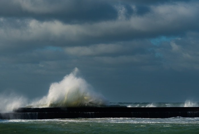

The Highest Recorded Tsunami in History — What Happened and Why It Still Matters
>When most Americans think about tsunamis, they think about the 2004 Indian Ocean disaster or the 2011 Tōhoku wave that devastated Japan. Both were catastrophic. Both killed tens of thousands of people. Neither produced the highest recorded tsunami in documented history.
That distinction belongs to an Alaskan fjord most people have never heard of — and the wave it generated on a July night in 1958 that reached a height no ocean wave before or since has officially matched.
The highest recorded tsunami measured 1,720 feet — roughly 524 meters — above sea level. It happened at Lituya Bay, Alaska. And two fishing boats caught directly in its path somehow survived to tell the story.
Lituya Bay, Alaska — July 9, 1958
Lituya Bay is a T-shaped glacial fjord on Alaska’s remote Gulf Coast, about 100 miles southeast of Yakutat. It is not a place most people visit. The bay is notoriously treacherous — a narrow entrance, powerful tidal currents, and a geological history that the local Tlingit people had recognized as dangerous for generations. Their oral histories described giant waves in the bay long before Western science arrived to measure them.
On the evening of July 9, 1958, a magnitude 7.8 earthquake struck the Fairweather Fault — one of the most seismically active fault systems in North America — directly adjacent to the bay. The quake triggered a catastrophic rockslide at the head of the bay. An estimated 90 million tons of rock and glacier ice plunged into the water from a height of approximately 3,000 feet.
The impact displacement generated a megatsunami — a wave type distinct from typical seismic tsunamis in that it is caused by massive material impact rather than seafloor movement. The water surged up the opposite slope of the bay to a trimline — the visible boundary where trees were stripped clean — of exactly 1,720 feet above sea level.
To put that number in physical context: 1,720 feet is taller than the Empire State Building stacked on top of itself. It is higher than any skyscraper currently standing on Earth. This is the highest recorded tsunami wave height in documented human history and it occurred in American waters.
The People Who Were Actually There
Three fishing boats were anchored in Lituya Bay that night, sheltering from weather before attempting the dangerous passage through the narrow entrance.
Howard Ulrich and his seven-year-old son were aboard the Edrie. Bill and Vivian Swanson were on the Badger. Orville and Mickey Wagner occupied a third vessel, the Sunmore.
The Wagners were never found.
Howard Ulrich later described watching the wave approach from the head of the bay — a wall of water moving toward them with enough force to carry 40-foot trees like matchsticks. The Edrie was lifted over the spit at the bay’s entrance and deposited outside. Ulrich later recalled being able to look down at treetops from his boat deck as the wave carried them.
The Swansons on the Badger were lifted completely over the La Chaussee Spit — the narrow gravel barrier separating the bay from the open ocean — and survived after their boat sank and they escaped in a small dinghy.
Their survival, against every rational probability, transformed the highest recorded tsunami from a pure geological event into a human story that researchers have returned to repeatedly in the decades since.
Dr. Hermann Fritz, a coastal engineer at Georgia Tech who has studied the Lituya Bay event extensively, has described the 1958 megatsunami as a natural laboratory for understanding wave mechanics at scales that cannot be replicated experimentally. The trimline — the physical scar on the hillside — remains visible today and is studied by geologists assessing tsunami risk in similar fjord environments across Alaska, British Columbia, and Norway.
Why the Highest Recorded Tsunami Was Not the Deadliest
This is the question that surprises most people when they first encounter the Lituya Bay story.
The highest recorded tsunami killed two people — the Wagners. The 2004 Indian Ocean tsunami, with a maximum wave height of approximately 100 feet in some locations, killed an estimated 227,000 people across fourteen countries. The 2011 Tōhoku tsunami, with waves reaching up to 133 feet in Miyako, Japan, killed nearly 20,000.
The difference is geography and population density. Lituya Bay in 1958 was an extraordinarily remote location with three fishing boats in it. The wave height was staggering but its destruction was contained by the fjord’s geography and the absence of coastal communities in its path.
Wave height and tsunami lethality are related but separate variables. The highest recorded tsunami had immense height because of the unique geometry of the fjord — a confined, steep-sided channel that amplified the wave vertically rather than allowing it to spread horizontally as open-ocean tsunamis do. The same event in a populated coastal area would have been incomprehensible in its death toll.
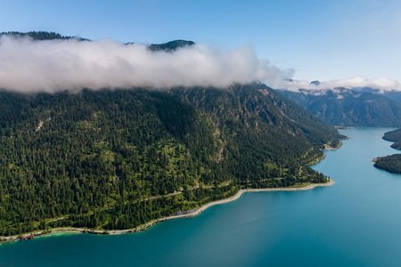
What the Highest Recorded Tsunami Taught Modern Science
The Lituya Bay event fundamentally changed how geologists and coastal engineers think about tsunami risk in fjord environments. Before 1958, megatsunamis of this scale were considered theoretically possible but had not been documented with surviving witnesses and measurable physical evidence.
The visible trimline provided something rare in geology — a precise, verifiable measurement of wave run-up that could be cross-referenced against witness accounts and subsequent modeling. This data has directly informed tsunami hazard assessments for coastal Alaska, the Pacific Northwest, and similar fjord systems globally.
Ongoing geological surveys of Lituya Bay and the surrounding Fairweather Range continue to identify unstable slope material that could generate future events. The Fairweather Fault remains seismically active. Researchers at the USGS and Alaska Division of Geological and Geophysical Surveys have identified at least one slope adjacent to the bay that carries risk of generating another large wave event under the right seismic conditions.
The highest recorded tsunami was not a once-in-civilization anomaly. It was a warning with a trimline drawn in the hillside.
FAQs About the Highest Recorded Tsunami
Q: What was the highest recorded tsunami in history and where did it occur?
The highest recorded tsunami reached 1,720 feet — approximately 524 meters — above sea level at Lituya Bay, Alaska, on July 9, 1958. It was generated by a massive rockslide triggered by a magnitude 7.8 earthquake on the Fairweather Fault. It holds the official record for the greatest tsunami wave height in documented history.
Q: How is the highest recorded tsunami different from the deadliest tsunami?
Wave height and death toll are separate measures. The highest recorded tsunami at Lituya Bay killed two people because the bay was nearly uninhabited. The deadliest tsunami on record is the 2004 Indian Ocean disaster, which killed approximately 227,000 people despite producing wave heights far lower than the 1958 Lituya Bay event.
Q: What causes a megatsunami versus a regular tsunami?
Regular tsunamis are typically generated by seafloor displacement during underwater earthquakes. Megatsunamis are caused by massive above-water or near-surface impacts — rockslides, glacier calving, volcanic collapses, or in theoretical cases, asteroid strikes — that displace enormous water volumes instantaneously. The confinement of a fjord or bay amplifies wave height dramatically compared to open ocean conditions.
Q: Could a similar event happen again at Lituya Bay?
Yes. Geologists have identified unstable slopes adjacent to Lituya Bay that carry documented landslide risk under seismic conditions. The Fairweather Fault remains one of the most active fault systems in North America. Researchers consider a future megatsunami at this location a matter of geological probability rather than possibility.
Q: Are there other locations at risk of producing a highest recorded tsunami level event?
Several fjord systems in Alaska, British Columbia, and Norway have been identified as having similar geological preconditions — steep unstable slopes above deep confined water bodies in seismically active zones. The Taan Fiord in Alaska generated a significant megatsunami in 2015, reaching approximately 633 feet — still less than half the height of the 1958 Lituya Bay wave but confirmation that such events continue to occur.
Q: Can the highest recorded tsunami type of wave reach populated coastlines?
Megatsunamis generated in confined fjords typically lose most of their extreme height rapidly upon entering open water. However, the initial wave within the fjord itself would be unsurvivable for any coastal community in its path. Populated areas along open coastlines face greater risk from conventionally generated seismic tsunamis, which maintain destructive energy across thousands of miles of open ocean.
The highest recorded tsunami happened in American waters, survived by ordinary people doing ordinary things on an ordinary summer evening. The geological record carved into that Alaskan hillside is still there — still measurable, still studied, and still telling anyone who looks closely enough that the earth operates on a scale of force that demands consistent, unglamorous respect.
Keep exploring: What Time Is the Lunar Eclipse Tonight and How to Watch It From Anywhere in the U.S. · Best Place for Northern Lights — From Alaska to Iceland Here Is What Actually Delivers · Northern Lights Tonight NYC — Skip the Rooftop Bars and Go Here Instead · The Real Distance from Florida to Cuba by Boat and What It Means for Travelers
Further reading: Lituya Bay
Further reading: USGS

Pingback: What Time Is the Lunar Eclipse Tonight and How to Watch It From Anywhere in the U.S. - My Travel Tweaks